Enjoying Poetry 101
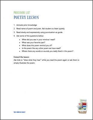
Your Free Cheat Sheet!
Click the image to download the printable procedure list and questions.
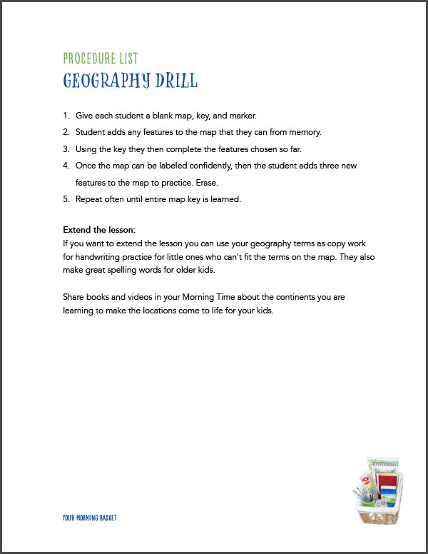
How to do a Geography Drill
How to do a Memory Palace
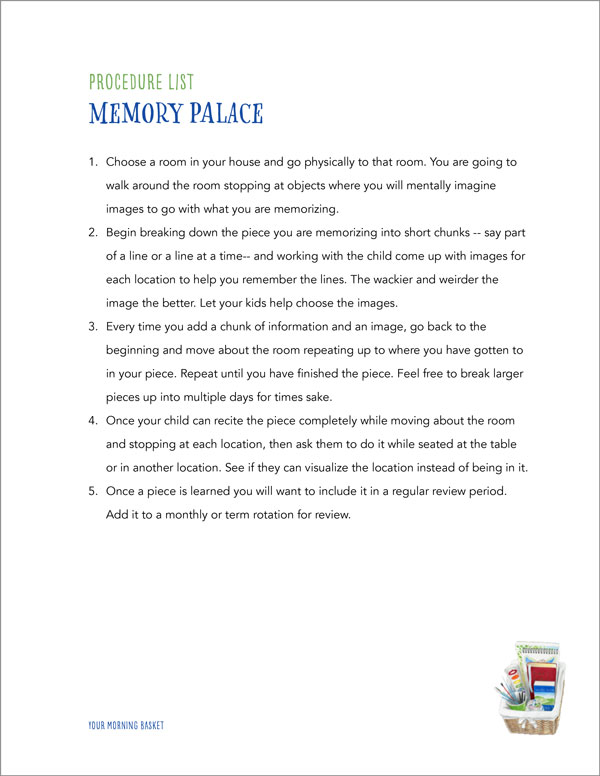
Your Free Cheat Sheet!
Click the image to download the printable procedure list and questions.